El Tanque
A rural upland municipality with views of the sea and Teide.
History
El Tanque is a rural municipality in the mid-altitude highlands of north-western Tenerife, wedged between Garachico, Los Silos and Santiago del Teide, and one of the few towns on the island with no access to the sea. Its territory was historically part of the old Guanche realm and, after the conquest, of the wide Daute region, which organised the whole north-western quadrant around the mother parish of San Pedro de Daute. The town's name comes from a small tank or cistern built in the heights above Garachico to store and channel irrigation water; around it, together with the nearby hamlet of El Granel —named after a communal granary—, grew a scattered settlement of the medianías. From 1540 there was here a chapel dedicated to Saint Anthony of Padua, dependent on the parish of San Pedro de Daute, which became the heart of the community.
The calling of these high lands was farming and livestock from the very beginning. Los Partidos de Franquis and La Atalaya, documented as early as around 1605, were large grain and cattle estates held by old landowning families of Daute. For centuries El Tanque was one of the island's main grain producers, its landscape dotted with threshing floors where wheat and rye were winnowed. This demographic importance led the mayor of Garachico to delegate duties to an official for El Tanque and El Granel in 1621, and on 16 April 1642 the town achieved full legal status as a municipality. From that agrarian society it preserves notable buildings such as La Alhóndiga, a 17th-century structure that served as a communal grain store, town hall, school, prison and temporary parish, as well as examples of traditional Canarian architecture like the Casa de los Martelos.
The event that marked the town's history forever was the volcanic eruption of 1706. On 5 May of that year (the eruption lasted around 40 days, until mid-June), within the very municipal district of El Tanque, the Montaña Negra or Trevejo volcano opened up; its lava flows devastated fertile land and homes, buried the original church of Saint Anthony of Padua, and ran unstoppable northwards until they reached Garachico, destroying much of the town and choking its prosperous harbour, the most important port on the north of the island. The disaster transformed the regional economy and the landscape itself. In El Tanque reconstruction was slow: work on the new church began in 1707 and was not completed until 1729.
Recent volcanic activity returns in 1909, when the eruption of Chinyero —the last recorded on Tenerife— affected the municipal district and caused agricultural losses that, together with archaic cultivation techniques and the fragmentation of plots, fed intense emigration to the Americas, especially to Venezuela and Cuba. Those badlands and cinder cones are today part of the Chinyero Special Nature Reserve and the Corona Forestal Natural Park which, together with the Teno Rural Park, protect more than half of the municipality.
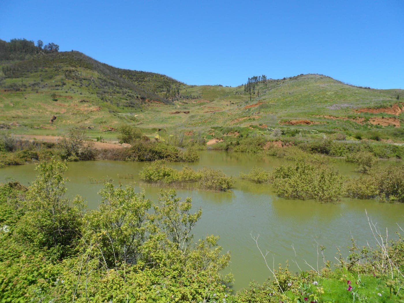
The Charcas de Erjos deserve a special mention as one of Tenerife's few wetlands. They appeared by accident in the final third of the 20th century, when the extraction of clay soil left hollows that fill with rainwater and have created a singular ecosystem of lagoons, Canary willows and reedmace, alongside the fayal-brezal scrub and laurel forest of Teno. Today they are a reference point for birdwatching and a symbol of the natural value of these highlands. The municipality, spread across centres such as the El Tanque village, San José de los Llanos, Ruigómez and Erjos del Tanque, has around 2,800 inhabitants and combines the survival of highland farming and livestock with a rural and nature tourism that takes advantage of its trails, its viewpoints over Garachico, Mount Teide and the Atlantic, and the authenticity of a quiet, deep-rooted Tenerife.
Points of interest
Iglesia de San Antonio de Padua
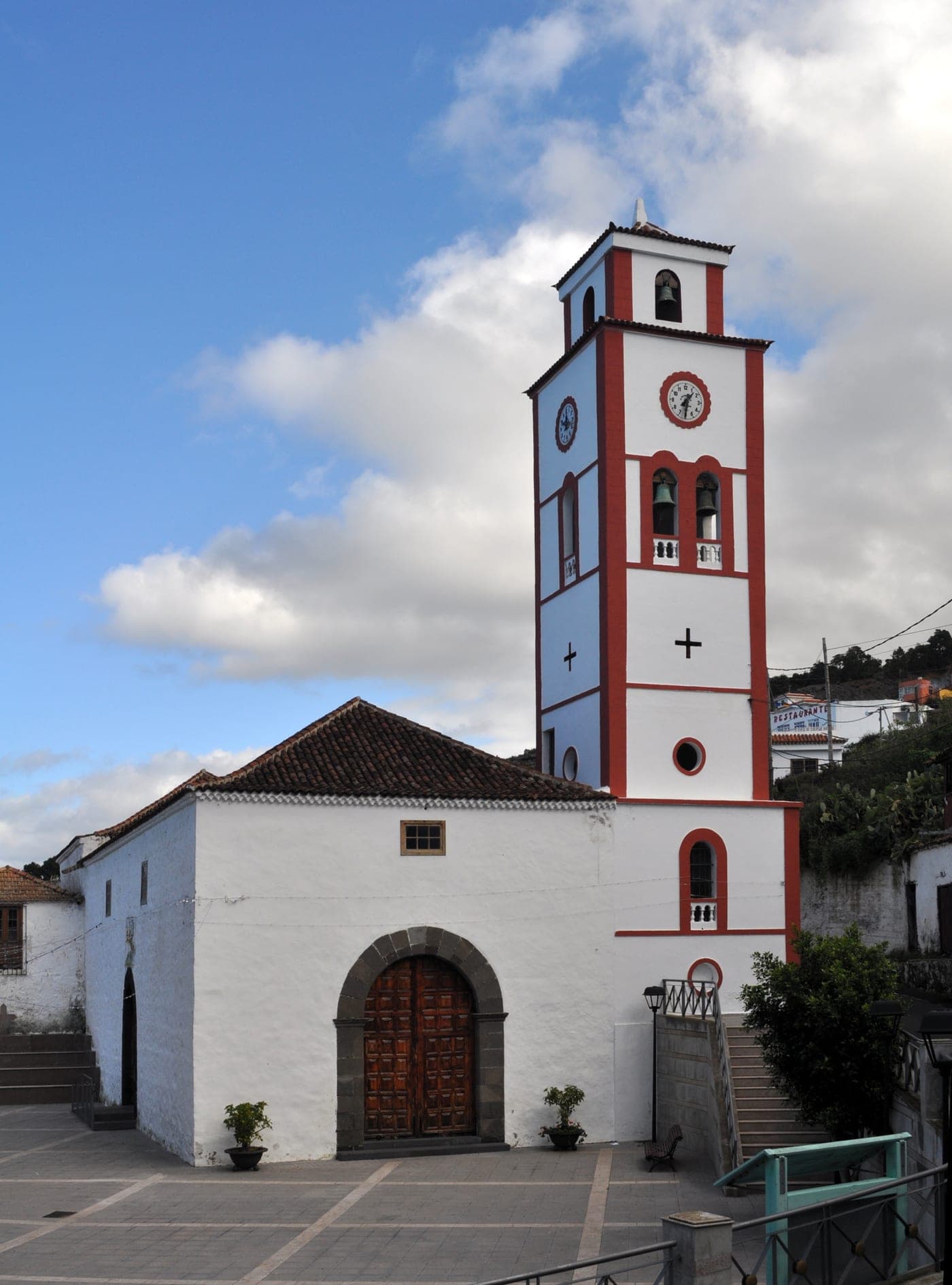
The parish church and historic heart of El Tanque, dedicated to Saint Anthony of Padua, patron of the municipality. It originates in an early chapel built around 1540 and dependent on the mother parish of San Pedro de Daute. That original church was buried by the lava flows of the 1706 eruption; the new building was begun in 1707 and completed in 1729. Of simple plan and traditional Canarian character, it preserves religious imagery and devotional pieces and shapes the life of the town, especially around the patron-saint festivities in June. It is a natural starting point for exploring the old quarter, where the municipality's main historic buildings are concentrated.
Volcán de Montaña Negra (erupción de 1706)
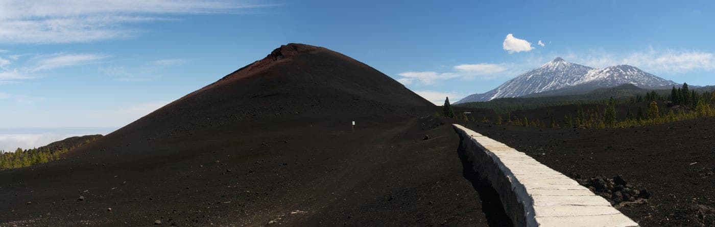
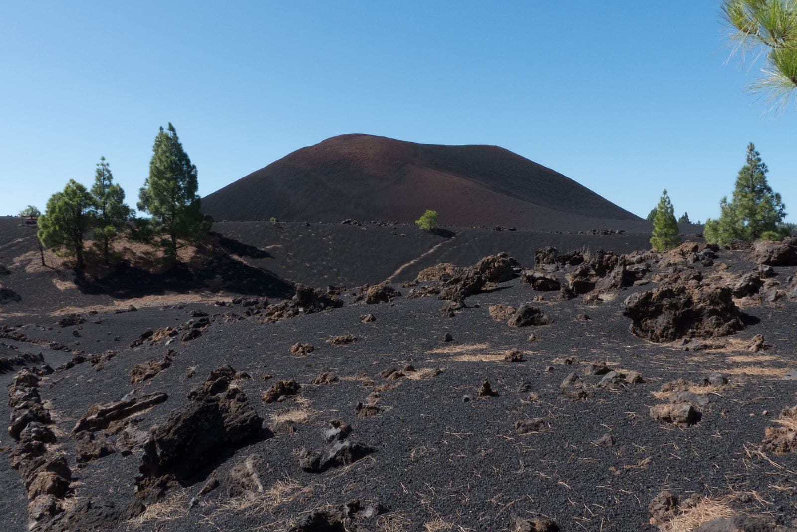
Also known as the Trevejo volcano, this is the cinder cone behind the most far-reaching eruption in the recent history of north-western Tenerife. On 5 May 1706 (the eruption lasted around 40 days, until mid-June), within the El Tanque district, its vents poured out lava flows that buried farmland, homes and the original church of Saint Anthony, and ran northwards as far as Garachico, destroying part of the town and choking its famous harbour, then the most important port on the north of the island. The resulting badlands of black rock and rugged forms make for a striking volcanic landscape, set within the protected area and crossed by trails that let visitors read, on the ground, the event that redrew the map of the region.
La Alhóndiga
An emblematic building in the El Tanque village, built in the 17th century as a public granary or communal grain store, in an age when the municipality was one of Tenerife's great cereal producers. Over its history it served many functions: besides a public granary, it was used as town hall, school, prison and temporary parish during the reconstruction following the 1706 eruption. Its austere traditional Canarian architecture, with stone walls and pine timberwork, makes it one of the most valuable physical witnesses to the town's farming and communal past, and an essential stop for understanding how life in the highlands was organised.
Charcas de Erjos
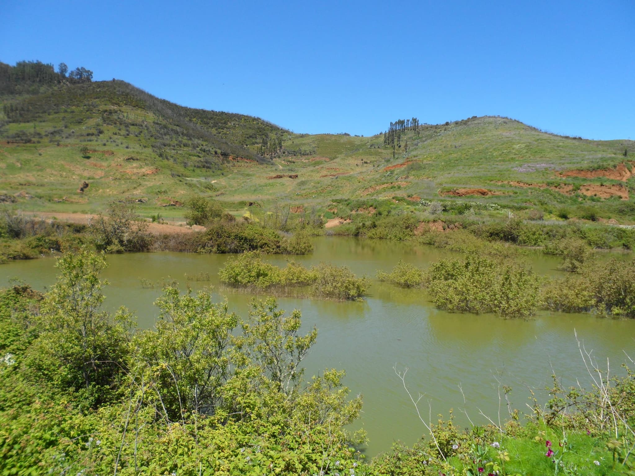
One of Tenerife's few wetlands, set in the high medianías shared between El Tanque and Los Silos, within the Teno Rural Park. The ponds appeared by accident in the final third of the 20th century, when the extraction of clay soil left hollows that fill with rainwater, creating a group of lagoons fringed by Canary willows and reedmace. Today they form a singular ecosystem and a key birdwatching site: they host waterbirds such as coots and moorhens, amphibians, dragonflies and, during migration, dozens of species. They are best visited with respect, keeping a distance from the wildlife and enjoying the surrounding fayal-brezal scrub and nearby laurel forest.
Parque Rural de Teno
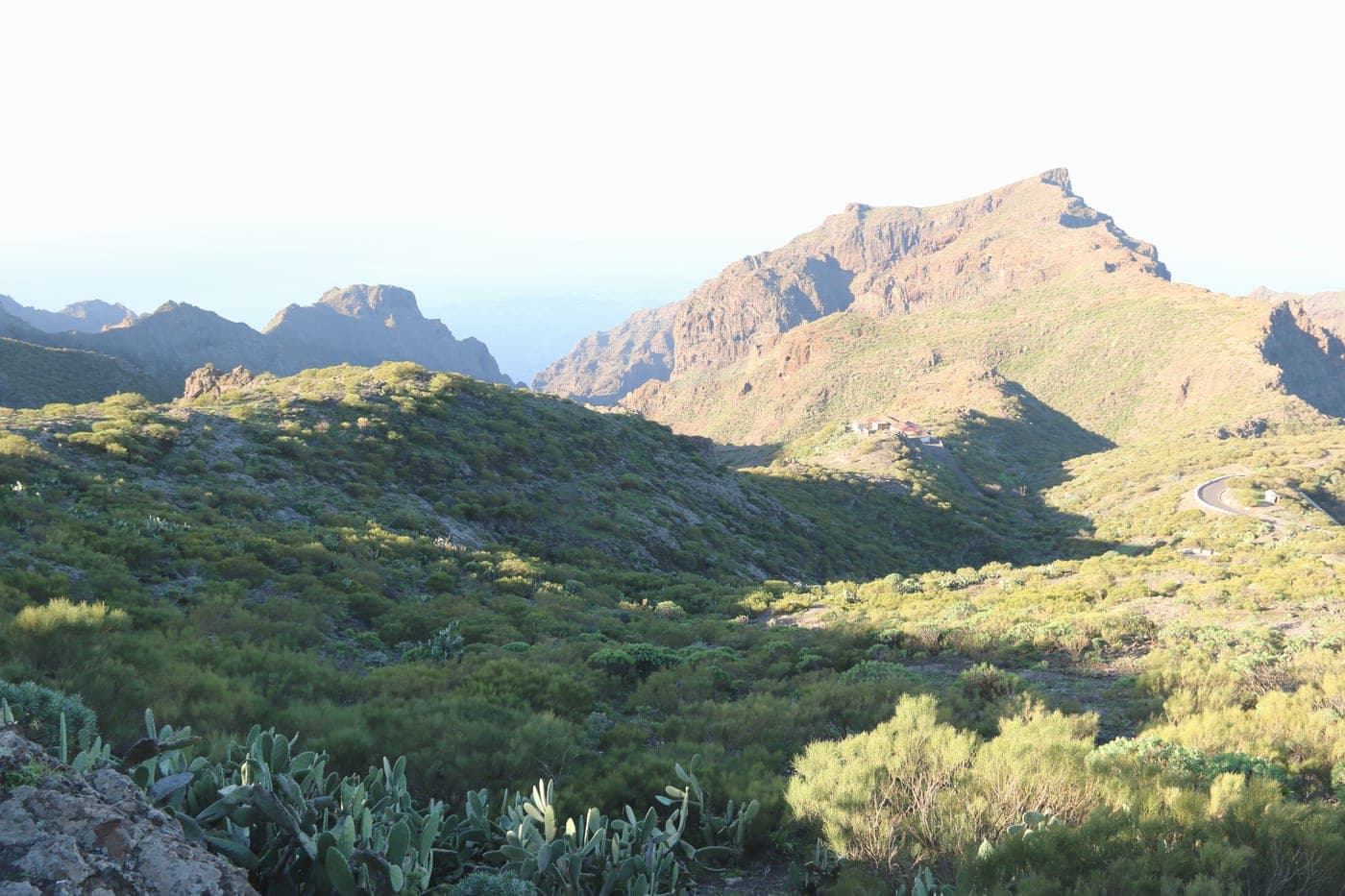
El Tanque shares in one of Tenerife's most valuable natural areas, the Teno Rural Park, which protects the island's far north-west with its laurel forest, its fayal-brezal scrub, its deep ravines and a landscape of great rural authenticity. Within the municipal district, the park covers the high medianías and links with sites such as the Charcas de Erjos, and it is complemented by other protected areas of the municipality such as the Chinyero Special Nature Reserve and the Corona Forestal Natural Park. More than half of El Tanque is protected, offering visitors a dense network of traditional trails, humid forests, viewpoints and well-preserved nature, ideal for hiking and nature tourism.
Miradores de las medianías
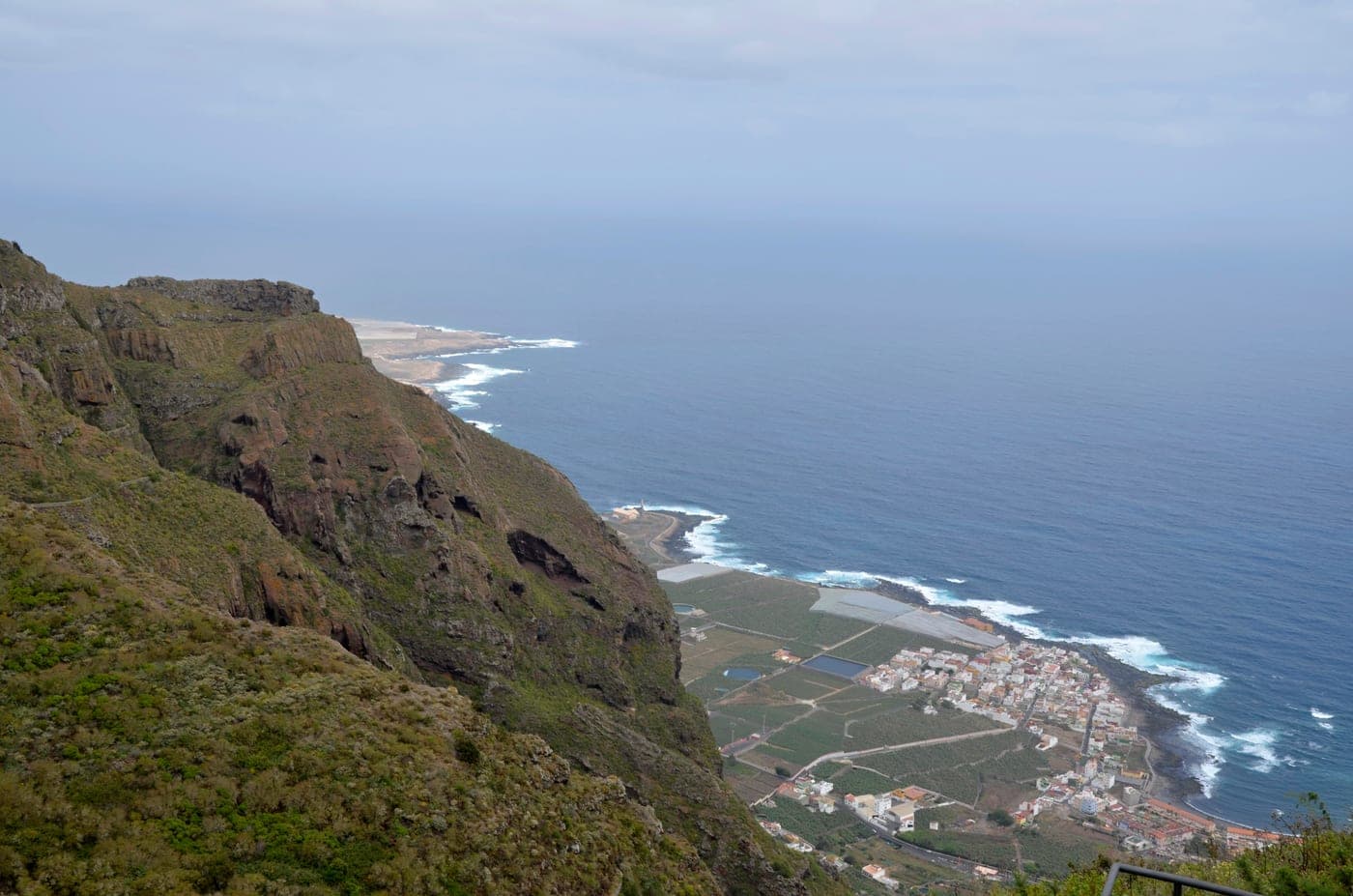
Thanks to its elevated position open to the north, El Tanque offers numerous panoramic spots from its highlands and rural roads. From them you can look down over the town of Garachico and its coastline —including the badlands born of the 1706 eruption—, as well as a wide horizon of the Atlantic Ocean and the Isla Baja, while behind rise Mount Teide and the summits of the Corona Forestal. The cool, humid climate of the medianías, with its blankets of cloud, brings memorable sunsets and seas of cloud. These viewpoints, reachable on foot or by car along quiet roads, are one of the municipality's great scenic attractions and the perfect complement to its trails.
Map of El Tanque
Things to do in El Tanque
Where to eat in El Tanque
What to see in El Tanque
Official data
Published by the Cabildo de Tenerife and reused here unmodified.
Waymarked trails12
- BC-1Ruta Forestal del Norte84.8 km+4600 mBike and horselinear
- PR-TF 51San José de Los Llanos - Punta de Teno22.6 km+933 mOn footlinear
- PR-TF 43Garachico - Chinyero18.7 km+1810 mOn footlinear
- VM-20Pista de Arenas Negras y Pista de Montaña Cascajo14.2 km+812 mMotor vehicles
- PR-TF 54Las Moradas11.3 km+677 mOn footlinear
- PR-TF 52Erjos - Las Portelas10.7 km+798 mOn footlinear
and 6 more
Recreation areas and viewpoints3
- San José de los LlanosCar park
- San José de los LlanosRecreation area
- San José de los LlanosCampsite
Listed heritage sites3
- CASA DE LOS GUZMANESEthnological siteOfficial gazette
- IGLESIA DE SAN ANTONIO DE PADUAMonumentOfficial gazette
- LAS PARTIDAS DE FRANQUISArchaeological siteOfficial gazette
Source: Cabildo Insular de Tenerife · CC BY · data from 2026-08-01 · How we use open data
Folklore & traditions
El Tanque's main festivities revolve around Saint Anthony of Padua, the patron of the municipality, celebrated on 13 June with religious ceremonies, a procession, open-air dances and a pilgrimage romería, one of the most eagerly awaited dates in the calendar of the highlands. Throughout the year, the different centres —the El Tanque village, San José de los Llanos, Ruigómez or Erjos— keep alive their own patron-saint and neighbourhood celebrations, where traditional Canarian music, dancing, decorated arches and the reunion of families who keep strong ties with the emigration to the Americas are never missing. Devotion and a strong sense of community, inherited from a farming people who for centuries shared threshing floors, granaries and the labours of the land, still shape the character of these festivities.
The rural roots are also reflected in livestock and farming traditions, with the rearing of goats and small livestock, the old cereal work and the craft trades tied to the highlands. The cuisine is honest and country-rooted: goat meat and kid, papas arrugadas (wrinkly potatoes) with mojo sauce, hearty stews and pork take pride of place, accompanied by local goat's cheese, wine from the Daute-Isla Baja region and traditional desserts. Products such as the highland potatoes and home-made pastries round off a simple, tasty cooking that visitors can enjoy at pilgrimages, festivals and in the hospitality of a municipality that proudly keeps its rural identity.
Photos: Martely | Noemi M.M. (CC BY-SA 4.0) · Paweł 'pbm' Szubert (CC BY-SA 3.0) · Javier Sánchez Portero (CC BY-SA 3.0) · Noemi M.M. (Martely) (CC BY-SA 4.0) · FrDr (CC BY 4.0) · Echeyde777 (CC BY-SA 3.0 es) · Wikimedia Commons